
To those who are wondering about Mati – Nabunturan Route, this blog is for you.
Work brought us to Mati, Davao Oriental sometime in March this year. And from there, we had to proceed to Nabunturan, Compostela Valley for another meeting the next day. If one had to do such in the past, that would mean going back to Tagum City via Surigao-Davao Coastal Road. But not anymore. In the recent years, the government opened up a new mountain road connecting both Provinces via Maragusan.
The GPS showed 2 hours travel time. Which made us think that the road must be good. 🙂 I surmised that with the distance and if the road is bad, it would take us at least half day to traverse this route. If possible at all. Now, google wouldn’t lie right? ha ha
Okay, the road was mostly concrete. Out of the 100 or so kilometers, only 4 kms. of it were in bad shape. The rest was a breezy drive. Really.
Check the pictures below.

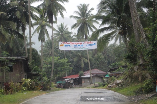
The church was full when we passed by this area. And then we found this Happy Fiesta sign as we went along. 🙂
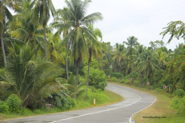
Curvy roads, look pretty right?


Okay, so this is one of those bad portions I mentioned above. But you can see that it is being done. Good news, right?

Moving on, I got amazed when I realized that the people below were there to clean up the highway. 
We reached a busy town. And yes, we found the rain. Or should I say, the rain found us. 🙂

More road works. 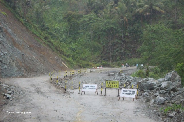
When you go up the mountain on a bad road. Scary, yes. But manageable. 
I love its color. That’s solid mountain rock. 

Don’t worry. This is part of the 4 kilometer unpaved road I mentioned. I’m sure it’s okay when it’s not raining. But with our luck, of course it had to rain during our trip. 🙂
As first timers in the area, we wondered how bad it will go as we continued on. We’re not just gonna quit and go back. We wanted a shorter route, after all. Plus it’s an adventure.

Yep, this is a high mountain road. About 900 meters high to be exact. Dangerous if you’re not careful. I am happy to share though that the hubby is a pretty good driver. Thank God.
The picture above shows where we came from.
And the one below is what’s in front of us.
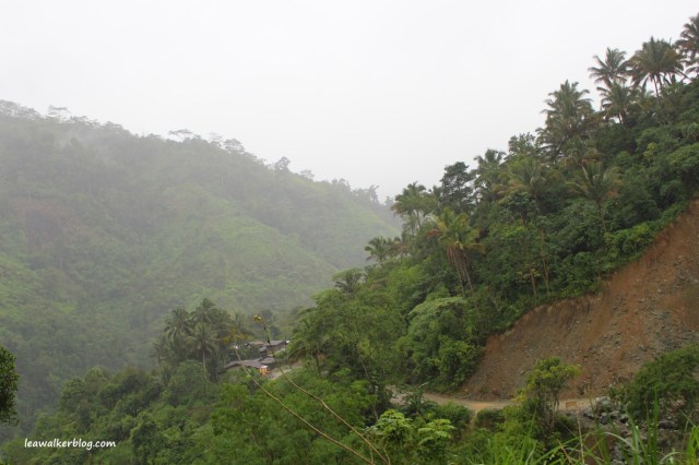
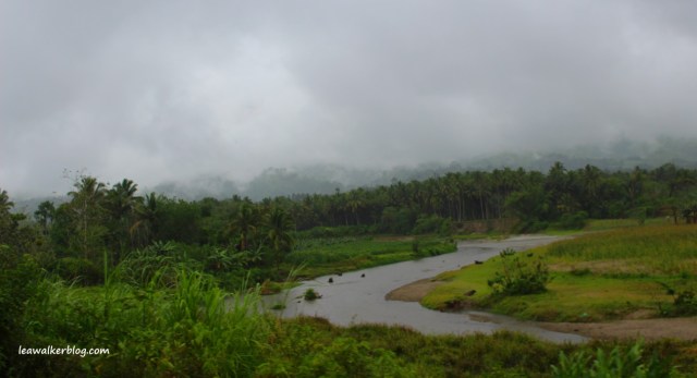
The mountains looked beautiful despite the rain. And the fog made them look ethereal.

At 900 meters above sea level, the temperature was 19’c.

See what I mean? Ethereal….


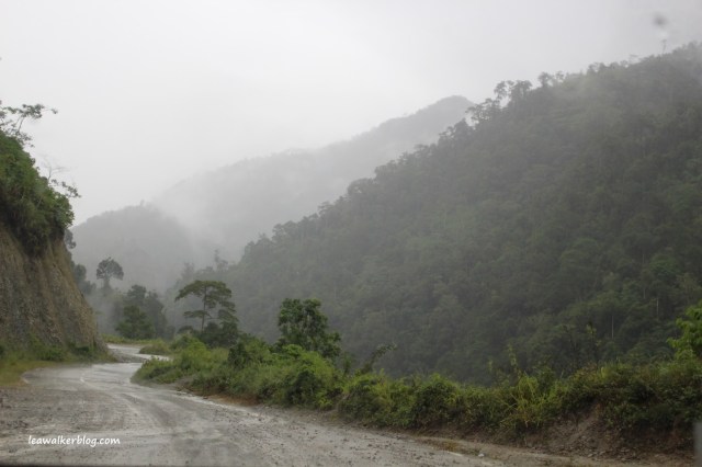
I love the mountain colors here. Never mind the small and unpaved road. Like I said, this is still part of the 4 kilometer bad portion. Meaning, there are several portions that are still being done or being repaired. But they total to 4kms only. Not bad considering the view. And the time you save going this way.

Okay this is when I saw the Highway 906 sign.

The sign below says: Boundary of Montevista, Compostela, New Bataan and Maragusan.
Our Department of Tourism should promote this area and put up a Four Corners Monument, just like in America. Referring to the boundaries of Colorado, Utah, New Mexico and Arizona.

The four corners above, can be like the one where I am standing at. Sorry I am so late in my blogging posts that I still have not written about this portion of our US Road Trip. But thanks to John for this memory.
See D.O.T. , people will come if you develop and promote the place. Maragusan and Compostela are two of the most beautiful places in Mindanao that I’ve been to. The hot springs and cold springs alone are more than enough reason to visit them. I’m sure Montevista and New Bataan have their share of beautiful places as well.

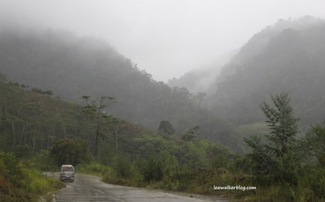
Moving on, we found a passenger van finally near Maragusan. 🙂
Maragusan. Their LGU should put up a big and colorful signage, to welcome the tourists in the area.

Not this dirty, old thingy in the middle of the road.
Hey guys, this signage does not speak for Maragusan. Believe me, the place is so beautiful with its lush and verdant forests and mountains.

After Maragusan, we turned right and headed towards Nabunturan, Compostela Valley. This is where I saw the Highway 907 sign.

Yep, it rained on us the whole time. But the mountains covered with fog looked amazing. I wouldn’t miss that for the world.

Another short portion of unpaved road below. (Still part of the 4 kilometer I mentioned above).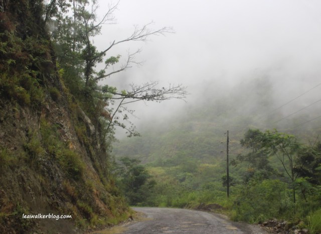
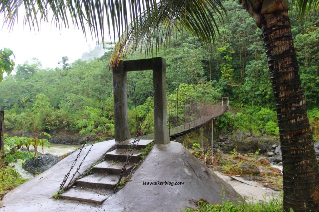
We noticed this river beside the road on our way to Nabunturan proper. 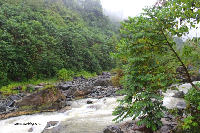

And this rustic bridge. Beautiful right? I would have wanted to stay longer but the rain just won’t stop. Hopefully I get to go back one day without the rain. So I can see more of its panoramic vista.

As we continued with the trip, the fog display wasn’t over yet. 🙂

And here I saw the Metro Bus. I think this came from Davao City. On the way to Maragusan. 🙂
Very pretty mountain side.


The sky was dark that day. But even so, it couldn’t hide the beauty of the place. Imagine how pretty this is when the sun is shining brightly and with blue skies?

Okay, so we’re back to another crowded town in the Philippines.
Welcome to Nabunturan.

It felt like the trip was longer than 2 hours , with all the pictures I took. But it wasn’t. Google was actually right. 🙂
So, was it worth it? To us, it was. Now we know that it can be done. And it was safe too. Plus with the beautiful landscape and scenery, we’ll do the trip again given the chance.
To give you a better perspective of where we were, check the google map below:

Thanks for traveling with us everyone!
If you try this route, make sure that you do this during day time. I am sure it will be pretty dark at nights because I did not see light posts in some areas. Plus of course, since you’re in the mountains , there won’t be much help if you have an emergency. So be an intelligent traveler. Be careful and have fun! 🙂
And please, please , please … don’t throw your garbage on the road. That’s just not right.
Lea C. Walker
http://www.davaoproperties.com
