We woke up about 5′ in the morning. Too early to do anything, we thought. Breakfast at the hotel doesn’t even start until 2 hours later. 🙂 It would have been nice if we could go back to sleep, but we couldn’t. So after a short discussion, we changed our plan for the day.
Instead of doing the sight seeing trip in downtown Seattle, we decided to check out Mt. Rainier National Park.
Armed with the Atlas Map and the GPS, we left the hotel an hour later.
We found this light traffic on the way to Carbon River .

Breakfast before reaching Carbon River.

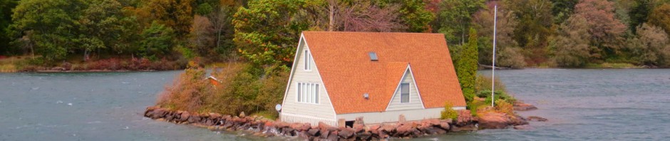
The view of Mt. Rainier from the town.

Going up the mountain.
We were just going by the Jeep’s GPS. At this point, we noticed that there were no signs going to Mt. Rainier. So we wondered if we were lost. But the view was beautiful. And we thought, this is America. Even if we’re lost, we’re still safe. 🙂 So we just kept on …

The river looked small from the top. 🙂 Think how high we were. he he

I don’t like switchbacks. But if you’re going up the mountain, then this is part of it. 🙂

Found a deer. When she saw us, she immediately went back. I wasn’t fast enough.

After awhile, we found the Carbon River Ranger Station.
Funny story coming up. 🙂 Just continue reading….

The park rangers were busy entertaining questions of the other tourists. So we waited. And took photo of the station’s interior. I love the fireplace. 🙂

When it was our turn, I asked the older ranger – sir do you have a map like this? Pointing to the map on their counter. He said – “yes, it’s by the window’. So I went there as instructed. Took a map. And then I saw a ref magnet. I took one for my mother and paid for it. We said thank you and left.
I took this photo on our way back to the Jeep. Isn’t that beautiful? And so peaceful?

About 5 minutes later, we saw this sign. 🙂
Then we noticed, there’s no one there. Weird for a very famous park. Where did the other tourists go, we wondered…

So we didn’t get out of the vehicle. Just made a turn at the boundary. Turned right at the bridge.

This bridge. So beautiful right? Specially with the fog on top.
The State of Washington is known for their evergreens. So pretty…

The river view.


When we reached the other side of the bridge, there was nothing there. We found some trails though. So we went back to the ranger station to make some clarifications.
On our way back to Carbon River station, I was able to get another drive by photo of the river.

With the map I got at the station earlier, we went inside to talk to the park ranger. This time, the younger ranger entertained us. Then he explained, we were holding on to a trail map (which we obviously didn’t read). ha ha… Okay, makes sense. No wonder we didn’t see anyone there. The other tourists took the trail going up Mt. Rainier.
Then, the ranger said – “where did you get this?” Referring to the map.
I said “by the window”. Remember that’s what the other ranger told me earlier.
He said – “this costs money…” Looking for the price at the back at the map. Gee, true enough there was a tag of $16 dollars something at the back.
I looked flabbergasted. And John burst out laughing. It’s so embarrassing right? I just realized that since I did not pay any attention, I technically stole a walking trail map of Mt. Rainier at the ranger station. Tsk.. tsk…
I must have looked so red that the park ranger asked “do you want it?” I said no. But I would pay for it . He said, no I will just put it back there. I apologized for the mistake. And said thank you.
If I wasn’t so embarrassed, I would have laughed about it. John couldn’t help and kept on chuckling though. 🙂
I have been to so many parks in the past and maps are just freebies. So I was so surprised that said map was for sale. But the lesson of this story is – pay attention. 🙂
Moving on, we followed the ranger’s instruction and went back to where we first started. If you do this trip on your own with only GPS as your guide, take the White River station. It will take you to the top.


Up and up and up, we go….


And then we found the fog on top. 🙂 Beautiful right?


Here’s the view of Mt. Rainier . Or a part of it. The mountains were covered with fog that time.

My first close up glimpse of a glacier.

The road with a view . Sunrise road was completed in 1929. Its master plan was designed by a National Park Service Architect, this road runs along a canyon rim to avoid cutting through fragile meadows. The road was also designed with the Emmons Glacier and the surrounding views, in mind.
I commend the US National Park Service for everything that they do to protect the environment and its landscape. They really make the parks so beautiful without ruining its eco system.


The Palisades Lake, as viewed from the Sunrise Road.

One would think that this is where it ends. Right? But no, the sun road doesn’t end here.
The road continues. And the view of the snow-capped mountains got bigger, beautifully looming above us.

And then we found more fog… And snow!!! 🙂


Finally, we reached the utmost top. We were greeted with the view of Sunrise Visitor Center and Sunrise Day Lodge. Both establishments are open until September only. The sunrise road is closed during winter.
The view on top.
My first snow during this trip. 🙂


Sunrise Day Lodge, behind the hubby.


Sunrise Visitor Center.


At the meadow. It felt like Christmas. ha ha


Me, having fun!!! 🙂


This is just a small part of Mt. Rainier. If you like nature and walking on trails, then this is for you.
Ours was just a day trip. And yet, we had fun….. 🙂
Lea C. Walker
